
Happy Valley Firewise Neighborhoods
“Fire is a good servant but a bad master.”
–Old Proverb
From the ashes of Pacific Palisades’ wildfire, we are learning important lessons... again. The mounting evidence of the need to improve our community’s ability to withstand wildfire is undeniable. Preparing for wildfire is the job of everyone living in high-risk areas like Happy Valley, not just firefighters. The good news is that the science of wildfires is now well-documented – we just need to act upon the findings.

Happy Valley takes the lead
We have created a customized map highlighting the HVIA’s 19 Firewise communities. Fire hydrants within the HVIA community are also visible in the map’s detailed view. How far is your house from the nearest fire hydrant? The farther away you are, the more your home needs to be able to defend itself against wildfire risk alone. Expect your insurance carrier to be looking at that distance as it assesses your home for risk.

Shift happens as wildfire maps change
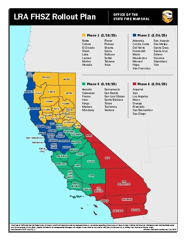
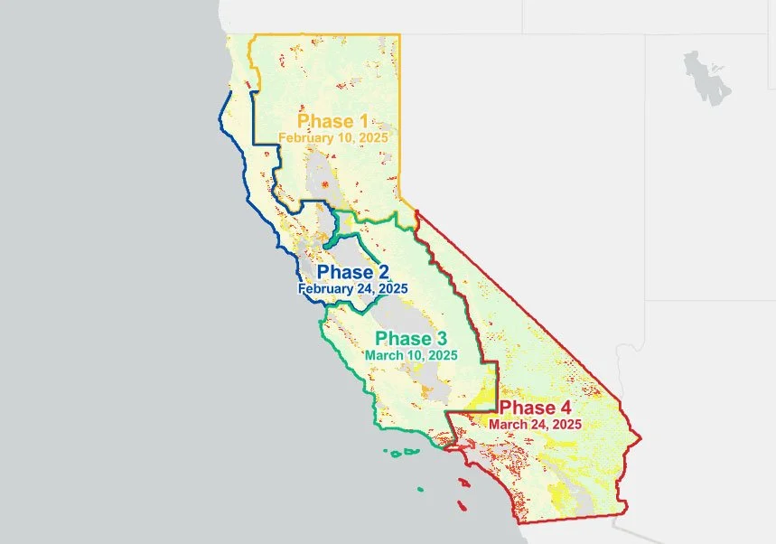
Earlier this year, CalFire updated its map of Fire Hazard Severity Zones. These maps highlight degrees of wildfire potential based on fuel type, terrain, weather, and other pertinent factors. Prior to this update, which becomes effective July 1st, virtually all of HVIA’s homes were in an area designated as a Very High Fire Hazard Severity Zone (VHFSZ). Now, with High and Moderate Fire Hazard Severity zones being introduced, only a small number of HVIA- based homes remain labeled as Very High, and most are being re-designated High Fire Hazard Severity Zone (HFSZ). The remaining homes are in either the Moderate or undesignated zones.
Find your home on the map
To see how these zones have changed from the previous map, use the Before and After LRA Map to find the split screen bar and move it across the map. Identify your property’s zone, using Fire Hazard Severity Zone Viewer. Select the search icon to enter your address to see the colored intensity of your zone (e.g., Red=Very High, Orange=High, Yellow=Moderate, none=undesignated).

The map versus insurance evaluations
How does this CalFire update affect your property?
Those homes no longer in a Very High zone will no longer be subject to ConFire’s inspections and the county will not be potentially requiring you to remediate wildfire risks around your home. Phew, right? Not really. California’s insurance companies do not rely upon CalFire’s maps of Fire Hazard Severity Zones. Their detailed risk models are more focused on how your specific home is prepared for wildfire risks. Mitigating wildfire risks on your property, particularly in the area within five feet of property structures known as Zone 0, may be your ticket to retaining fire insurance.
For those of you now in High and Very High Fire Hazard Severity Zones, keep in mind that under California law (AB 38), your property is already subject to the county’s risk-mitigating standards when you or your heirs decide to sell the property. You will then need to disclose your property’s failure to meet those standards or take steps to remediate them.
Why Firewise? Risks matter
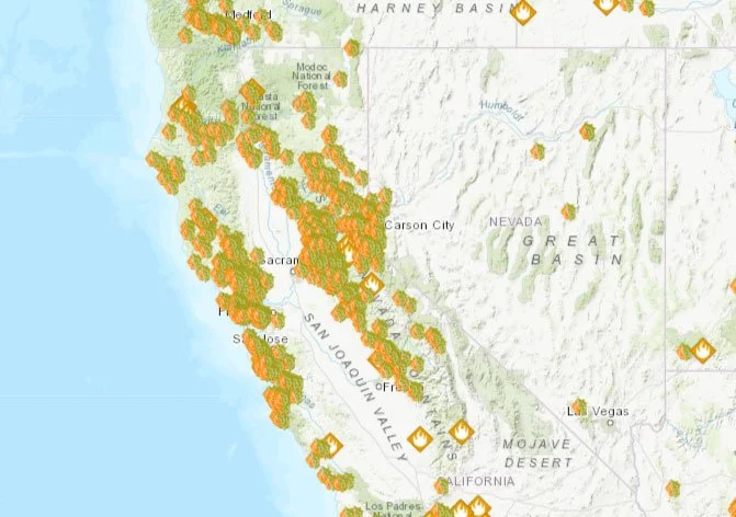
Based on wildfire science supported by experience, the national program called Firewise provides a standardized program for homeowners to manage wildfire risks. Since ConFire will not be able to defend all homes from a wildfire event, it is critical that residents living in high fire risk areas learn how to prepare their homes to withstand windblown embers from a wildfire. Hence, the growing demand for starting Firewise communities. Lafayette now has 25 Firewise communities, all started within the last five years, shown in the Firewise map.
Sadly, a quick glance at that Firewise site map also reveals that Pacific Palisades had none. While starting a Firewise community does not stop wildfires, the growing awareness of Firewise principles and their implementation, one home after another increases a community’s ability to withstand wildfires. Despite headline news often suggesting that luck determines whether homes survive, actual evidence reveals that when these principles are applied, homes are less likely to burn.
A Firewise certificate may be useful for individuals to retain insurance or get a discount on insurance premiums, but the real value of a Firewise-certified community is when most, if not all, homes are Firewise ready, thus providing some degree of immunity to wildfire risk. Mi casa, su casa. In short, it takes a village.
Five important steps to become more firewise
Ready to take steps to be more Firewise ready? Regardless of whether you are tight on time or money, here are five key steps you can take to help your house survive a wildfire event. Your real enemy is not the actual flames approaching; it is more likely the storm of wind-blown embers from fires that may be a mile or more away. Driven by the eddies of wind swirling around the contours of a home, these embers may cluster around the home’s foundations and roofs.
With that effect of wildfire behavior in mind, please consider the following measures.
-
1. Sweep Zone Zero
Remove all combustible materials within 5 ft of your house (dry vegetation, mulch, bark, firewood, wooden fences). Replace com- bustible landscaping with non-combustible alternatives (e.g., decorative rock or gravel, brick, sand, stone pavers). In a VHFSZ area, new state rules will likely require this clearance in Zone 0; for homes in a HFSZ area, a non-combustible Zone 0 will be required upon sale under AB 38, however negotiated by buyer or seller.
-
2. Ready Your Roofs and Decks
Clear gutters, roofs, and decks of accumulated fuels (leaves, nee- dles, and other dead vegetation) that can catch embers. Remove combustible items under decks. Cut branches within 6 ft of your roof, or within 10 ft of a chimney outlet. If you have a wooden shingle rooftop, deck, or fence attached to your house, consider non-combustible alternatives.
-
3. Seal Your Vents
Prevent embers from passing through vents into your attic or other spaces where flammable materials may lie unprotected inside. If you have vents with mesh greater than 1/8”, replace or cover them with non-combustible screens that can stop embers from entering.
-
4. Cut your grass
Trim all grass and weeds to a height of 3 inches or less around your property in accordance with county requirements for proper weed abatement.
June 1st is ConFire’s deadline for homeowners in Lafayette to complete their weed abatement requirements.
-
5. Think Lean, Clean and Green
Within the 30 ft perimeter around your home (known as Zone 1), clear excess vegetation clutter. For example, trim and thin each shrub to be free of dead vegetation. Remove lower branches of trees to create at least 6 ft of vertical clearance above the ground so that you eliminate “ladder fuels” that enable any flames at ground level to climb up to a tree. Reduce overlap between shrubs and trees so that fire cannot move directly across to your house.
-
FINAL NOTE:
If the National Weather Service declares a Red Flag Warning (a forecasted combination of warm temperatures, low humidity, and strong winds), that’s your cue to confirm you have properly addressed these five measures. If not done already, consider whether any combustible objects like BBQs, chairs, couches need to be moved outside of Zone 0. Remember the embers...and their insidious reach!